
Kernersville Neighbors on a Block
Public records around one Kernersville address are best read as separate layers, not as a list of people. A parcel map can show the lots that touch or surround the target. Tax information can carry a current-owner field and the parcel identifiers that connect to other county tools. The Register of Deeds can document a recorded transfer. Voter material can be a registration layer with its own limits. A historical street directory can place a named household at an address in a particular year. Each source has a different date, keeper, and meaning.
| Source | Block evidence it can provide | How the record is reached |
|---|---|---|
| Forsyth Tax Parcel Viewer | Parcel geometry, Official Address, PIN/REID, and current-owner fields | Online map; county counter or phone for property questions |
| Forsyth property information | Property record card and the distinction between location and mailing addresses | Online, Tax Office counter, or phone |
| Forsyth ROD / BIS | Recorded transfer parties, instrument date, legal description, and deed image | Online index, Register of Deeds counter, mail, or e-file channel |
| North Carolina voter records | Registration status, jurisdiction, precinct, and voter-history links where public | NCSBE lookup or data route; county Elections office for requests |
| Library and Digital NC | Historical address pages, newspaper citations, photos, and directory context | Online collections, library staff, microfilm, or Archives request |
Kernersville neighbors should not be inferred from a single label. A tax current-owner field is not recorded-title proof, and a recorded owner is not automatically the person at the address. A voter match is a registration record, not proof of present location. Record the source name, its date, and the exact label before comparing it with another source.
Kernersville Neighbor Parcel Labels
Start from the location, not a name. When comparing Kernersville neighbors, Forsyth's property tools distinguish a location or situs address, where the parcel sits, from a mailing address, where tax notices go. They can differ. The most useful handoff is the parcel's REID or PIN, copied exactly from Tax or GIS before looking for a recorded deed. This keeps a nearby-parcel comparison tied to a map feature instead of a similar street name or an unrelated mailing address.
- Parcel
- A mapped piece of land used in the county assessment system. Its boundary display is not a legal survey.
- REID and PIN
- County property identifiers that connect a map result to detailed property information and tax research.
- Situs address
- The physical location address for the parcel. It is the better key for placing a record on a block.
- Mailing address
- The address used for tax notices. It can differ from the parcel's physical location.
Use the deed and its legal description or plat to test title and physical relationship. The GIS itself warns that its data may change and is not a warranty of title.
Map a Kernersville Neighbor Block
The immediate-block method uses parcel geometry rather than a broad name search. Forsyth's viewer can search Official Address, Owner Name, Parcel Number, REID, and Block and Lot. Official-address searches accept partial addresses and documented abbreviations, while an address such as 1022 % main st illustrates the permitted wildcard approach. Once the target feature appears, the surrounding parcel shapes create the small comparison set. Do not turn map proximity into a conclusion about a household.
- Find the target in the Forsyth Tax Parcel Viewer and record its official address, parcel ID, REID, and county.
- Inspect only the adjoining parcel geometry or a bounded drawn shape. A point buffer works best when the buffer tool is used.
- Open detailed property information for each confirmed parcel and retain the source date and field labels, especially situs versus mailing address.
- Use the owner name and parcel identifiers in the deed index only to verify a recorded-property trail, legal description, or plat relationship.
For a whole named street rather than the parcels immediately around one address, the Kernersville street directory follows the larger street-by-street chain. Names on the map lead to records, not a list of current neighbors. Note: save the search date because map layers and parcel fields can change.
Kernersville Neighbor GIS Tools
The parcel viewer provides more than an address box. Its documented tools include map layers, legend, imagery change-over-time and swipe, basemap selection, map or report printing, measurement, drawing, sharing, table view, and CSV export. A drawn spatial filter can intersect the visible parcels, and the result table can be exported in batches of up to 1,000 rows. Mailing-label output is a map feature, not evidence that the names represent current neighbors.
Town GIS supplies a separate local context layer for municipal limits, ETJ, zoning, land use, overlays, parks, schools, fire, watershed, traffic, and Forsyth/Guilford tax links. Development Services and the Town Clerk are the routes for Town-held planning, addressing, permit, agenda, or minute records. For an existing Town record that is not online, submit a specific request online, by emailed PDF, or in person. The Town need not create a new list or compile a research answer.
Kernersville Neighbor Voter Layer
A voter result can add a public registration layer to a Kernersville block, but it should not be used as an occupancy statement. The NC State Board of Elections Voter Search requires first and last name, allows an optional middle initial, birth year, and county, and provides Registered, Removed, and Denied status choices. A match can supply jurisdiction, polling place, sample-ballot, absentee, and voter-history links. Select Forsyth County only after checking the parcel county, because a Kernersville address near the line may require a different local office.
State files can include name, county voter ID, residence and mailing addresses, demographic and party fields, precinct and district fields, and voting history. Full Social Security numbers, dates of birth, and driver-license numbers are excluded. G.S. 163-82.10 also permits certain county or precinct lists and filters, subject to the law's access and cost rules. Protected addresses, removed status, and list maintenance can all create a valid no-result. The Forsyth County Board of Elections is the fallback for local list, precinct, district, phone, fax, mail, and public-records questions.
Kernersville Historic Block Context
For an earlier block, use address-based historical material rather than a modern label. Digital NC's 1960 and 1962 Kernersville directories arrange numbered streets numerically and named streets alphabetically, with household names opposite house numbers and intersecting streets at crossings. The 1960 material also has a numerical telephone section. These pages preserve a dated snapshot and can help test a street spelling, sequence of addresses, historic crossing, or former neighbors.
Paddison Memorial Library staff, the Forsyth Library newspaper index, microfilm, photos, and the State Archives are the follow-up channels when a historical address needs corroboration. A newspaper citation can record an event or civic mention, but it is not automatically a current fact.
Kernersville Civic Boards and Records
The research documents Town boards and civic records, not a private neighborhood-association directory. The Town Clerk maintains board and commission rosters, minutes, agenda packets, public notices, contracts, leases, and Town-owned deed or easement indexes. A published role is a civic connection at the time of that record, not proof of a person's current address. The advisory-board page and Town Clerk are the proper public sources for these documented connections.
| Documented Town body | Public-record route |
|---|---|
| Board of Adjustment | Advisory-board listing, Town Clerk, and meeting records |
| Community Appearance Commission | Advisory-board listing and public meeting materials |
| Mayor's Council for People with Disabilities | Advisory-board listing; the Town notes its 1984 founding |
| Planning Board | Advisory-board listing, agenda packets, and planning materials |
| Recreation Advisory Board and Sister City Commission | Advisory-board listing and Town Clerk routing |
The Kernersville advisory-boards page is captured below.
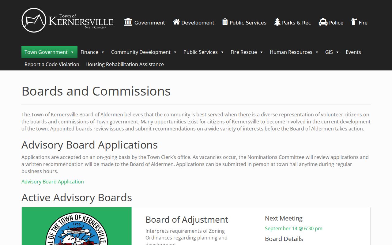
Use it for current public civic roles and route questions through Town Hall, rather than treating a board roster as a directory of local households.
Kernersville County Line Checks
A block can cross the wrong-office line. Kernersville's municipal land is primarily in Forsyth but also reaches Guilford, and a 2024 boundary resolution identified about 250 parcels along an uncertain Forsyth-Guilford line. ZIP 27284 can be broader still. For a target near that line, check both the Town municipal-limits material and the county parcel view before choosing a Tax office, Register of Deeds, clerk, sheriff, election precinct, or public-records route.
Boundary or title questions may need the recorded deed, plat, and, where appropriate, professional survey or title assistance. The map is a research aid, not a legal survey or a guarantee of ownership.
Kernersville Neighbors Tool Limits
Official records identify a custodian, record type, date, and access rule. Commercial neighbor tools may combine stale addresses and same-name material without showing the original source or its limits. For family history, civic transparency, reconnecting with a former classmate, or a property question, use the official source first and preserve its date. A commercial result is not a substitute for a parcel, deed, voter, library, or Town record.
| Question | Official record route | Commercial neighbor-tool limitation |
|---|---|---|
| Which lots adjoin an address? | GIS parcel geometry and parcel identifiers | May not show the mapped boundary or source date |
| Who is named on a property record? | Tax field, then recorded deed and legal description | Can mix current and historic names without an instrument trail |
| Was a name historically tied to an address? | Dated directory, library, newspaper, or Archives material | May omit the edition year or original context |
Kernersville Neighbors Privacy Limits
Public availability has limits. North Carolina voter files exclude Social Security numbers, dates of birth, and driver-license numbers, with further protections for qualifying addresses and certain agency or military information. Vital records have eligibility rules. Juvenile, sealed, expunged, and ACP-related information cannot be obtained by switching channels. The NC Address Confidentiality Program gives qualifying survivors a substitute address for mail and certain government transactions. Never use GIS, deeds, voter data, or historic directories to reverse an ACP or protected address.
Lawful use. Use records for lawful personal research and keep source dates and protections intact. Stalking and cyberstalking laws prohibit monitoring, harassment, unauthorized tracking, and related conduct with no legitimate purpose.
The North Carolina cyberstalking statute is the legal-limit source shown below.
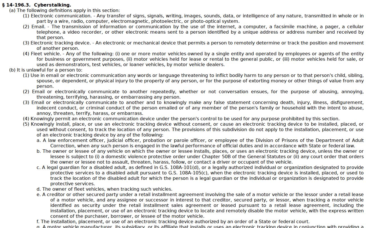
It reinforces that a public record is not permission to assemble a live-location dossier, contact a protected person, or publish private details.
The North Carolina Department of Adult Correction public offender search is a separate statewide source. Its current field inventory was not exposed during research, so verify the live controls and scope directly before relying on it. It does not establish who lives on a Kernersville block.
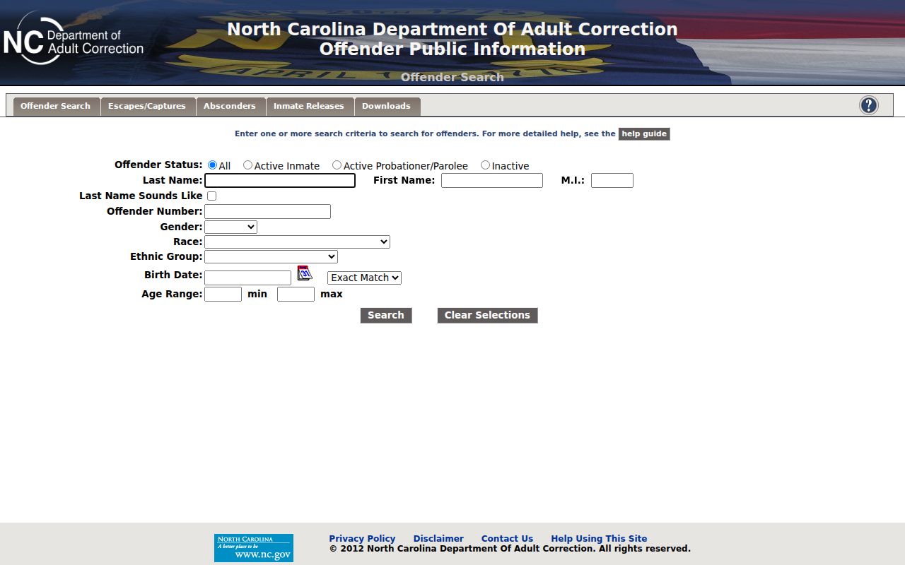
Use a dated official result only for the purpose and scope the agency publishes, and do not treat any such record as an address-confirmation tool.