
Walk a Kernersville Street Record
A Kernersville street directory works best as an address-to-record sequence, not a name list. First establish the exact address and county. Then use Tax to identify the parcel, map its position in the Parcel Viewer, and carry the PIN or REID to the deed index. Only after the parcel and recorded parties are clear should a searcher add a voter-registration or historical-directory layer. Those layers have different dates and purposes.
For a long street, work in house-number ranges or blocks and keep a note for each result: source, search date, county, address spelling, and label. The official street address is stronger than a postal-city guess. A parcel may cross a local geography question, and a named owner can be a business, lender, or former owner. The Kernersville street directory therefore shows a chain of address-keyed evidence, not a promise that it identifies every current household.
- Search the official address in Forsyth Detailed Property Information and save the PIN or REID with the situs address.
- Open the same parcel in the Tax Parcel Viewer, inspect geometry and adjacent lots, and note any county or limits issue.
- Use the parcel's owner field as a lead, then search the Register of Deeds for the current recorded instrument and earlier transfers.
- Use NCSBE only as a registration layer, with county and status selected, and never call the result proof of occupancy.
- For a past Kernersville address, test the original street form in the 1960 or 1962 directory and seek library or archive context.
Kernersville Address Search Keys
A complete key for a Kernersville address has a number, directional prefix when used, street name, street type, ZIP, county, and eventually a parcel identifier. The Forsyth tools support street-type abbreviations such as ST, RD, DR, LN, CT, CIR, AVE, and PKWY. The help material also gives an address pattern such as 1022 % main st. A percent sign is a wildcard, which can help when a street type or part of the address is uncertain.
Confirm whether the target lies inside Town limits, in the ETJ, or near unincorporated Forsyth or Guilford territory. The Town limits layer is dated October 8, 2021, while later boundary work adds another reason to preserve a map date. This Kernersville by-address method prevents a ZIP label from sending a request to the wrong office.
- Parcel
- A mapped land unit used in tax and GIS systems. It is not a roster of people at an address.
- Situs address
- The physical location of a parcel, which can differ from the owner's tax mailing address.
- Plat
- A recorded map that can clarify a parcel boundary, lot layout, or right-of-way.
- Criss-cross directory
- A historical address arrangement used to connect a street number with a listed household.
Kernersville Property Search Fields
Forsyth Detailed Property Information is the main owner-or-address search surface for this Kernersville street directory. Its field set is specific: Owner or Business Name, Location Address, REID, and PIN. It produces Property Record Cards. Search owner names last name first and use partial terms when the interface allows them. Once a result is found, carry the exact identifier to the parcel viewer instead of trying to rebuild the match from a display name.
| Property field | Street-directory use |
|---|---|
| Owner or Business Name | Starts from a known recorded or tax-linked party. |
| Location Address | Connects an official address to the property record. |
| REID | Transfers a record between Forsyth property tools. |
| PIN | Identifies the parcel for map and deed-chain checking. |
Open the Forsyth detailed property search to use those fields.
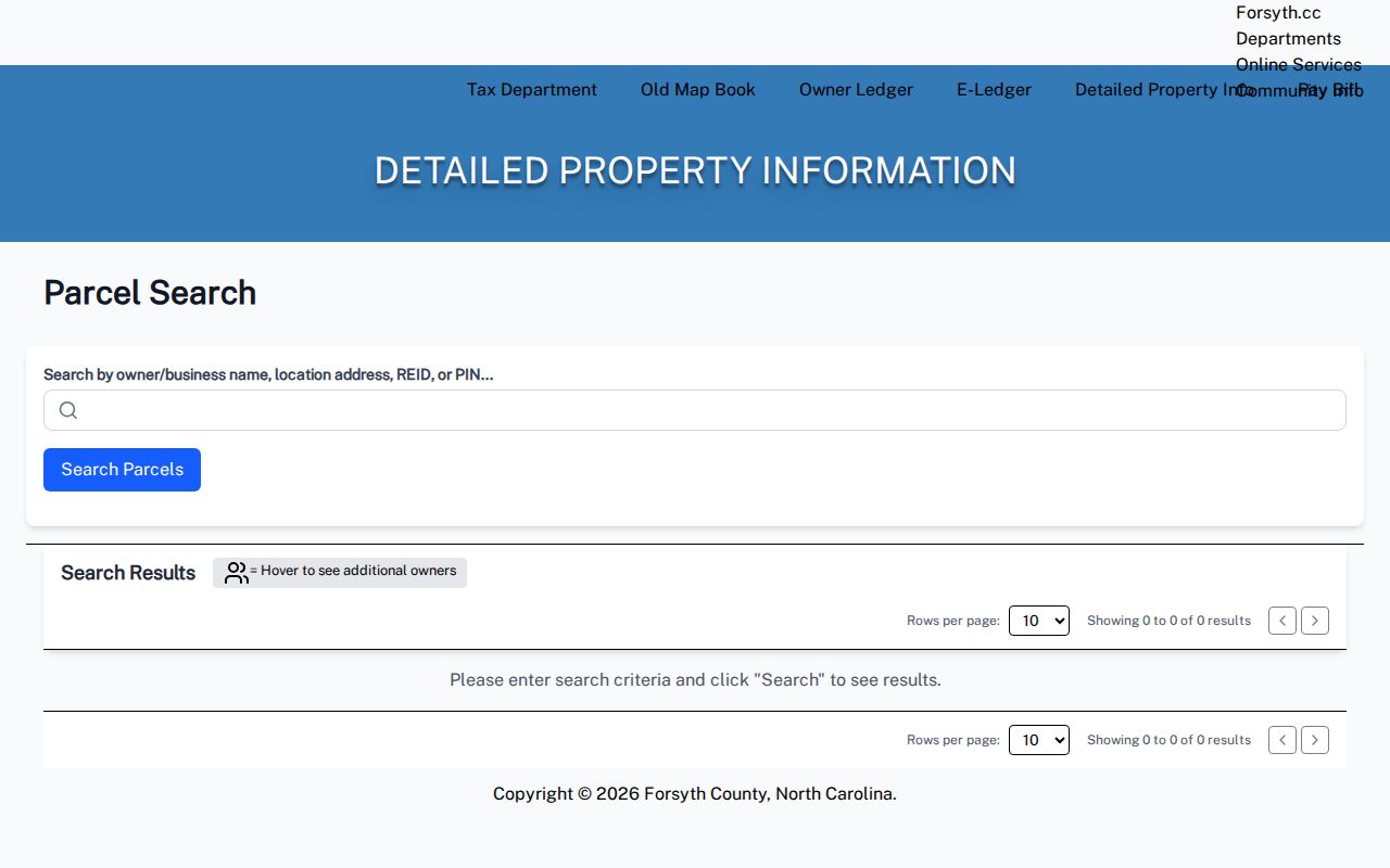
The search image shows the field-based starting point that ties a Kernersville street address to a record card and parcel key.
Kernersville Parcel Viewer Blocks
The Forsyth Tax Parcel Viewer broadens a single Kernersville address into the block around it. Its search keys include Owner Name, Parcel Number, REID, Official Address, and Block and Lot. Map tools include spatial drawing, measurement, table view, print map or report, imagery comparison, share, CSV export, and mailing labels. A spatial filter and adjacent-parcel geometry are more defensible for a block than a broad person-name search.
Exports are capped at 1,000 rows at a time. Divide a long street into bounded ranges and record the map date. Mailing labels are an export feature, not evidence of who lives there. GIS data can change and the county does not present it as a legal survey, boundary certification, or warranty of title.
View the County's property-lookup route before moving from a street number to parcel research.
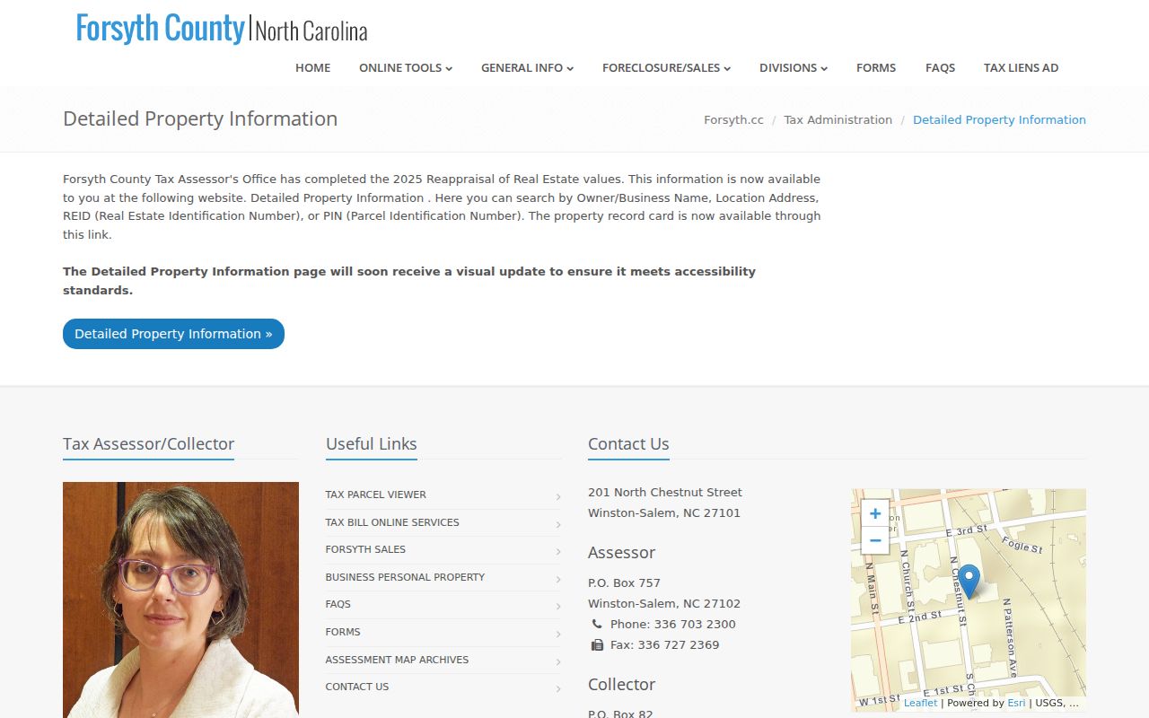
The property-lookup view connects a Kernersville by-street search to the county's record-card and parcel resources.
Kernersville Street Record Coverage
Different address-keyed records answer different parts of a Kernersville street question. Tax and GIS lead with the parcel; BIS records the transfer; Town mapping adds limits and planning context; voter data supplies a limited registration layer; and historic directories point to a past household. Keep the record type visible when notes are compared. A recorded transfer date is not an occupancy date, and a map boundary is not a surveyed legal conclusion.
| Address layer | Useful output | Kernersville access path | Interpretation limit |
|---|---|---|---|
| Tax property | Parcel, owner field, record card, and tax links | Online, Tax counter, or phone | Situs and mailing addresses can differ |
| GIS parcel map | Geometry, adjoining parcels, aerials, and exports | Parcel Viewer and Town GIS | Reference map, not a survey |
| Deed index | Parties, instrument, date, legal description, and image | BIS online, counter, mail, or e-file | Recorded party is not automatically a resident |
| Voter record | Registration status, jurisdiction, and selected public fields | NCSBE, county Elections, data files, or request | Protected and removed records may be absent |
| Historic directory | Dated household or business entry by numbered street | Digital NC, Paddison, microfilm, or library staff | Publisher snapshot, not a current roll |
Kernersville Deed Chains by Street
Once a parcel is identified, Forsyth's BIS name search is the recorded-instrument layer for a Kernersville street directory. It allows grantor or grantee searching, entity and party types, standard, full-text, and sounds-like choices, categories, dates, book and page or file number, sorting, and alphabetical browse. Note the current grantee, recording date, book or page, and instrument, then search that earlier grantee as a grantor to move backward.
Follow deeds of trust, satisfactions, easements, covenants, plats, and rights-of-way when they affect the legal description. Compare that description with the parcel map before treating two similar street addresses as the same property. The Register of Deeds also has counter, mail, and e-file channels if an online image or index does not settle the question.
Use the Forsyth deed-search controls for party, instrument, and date filtering.
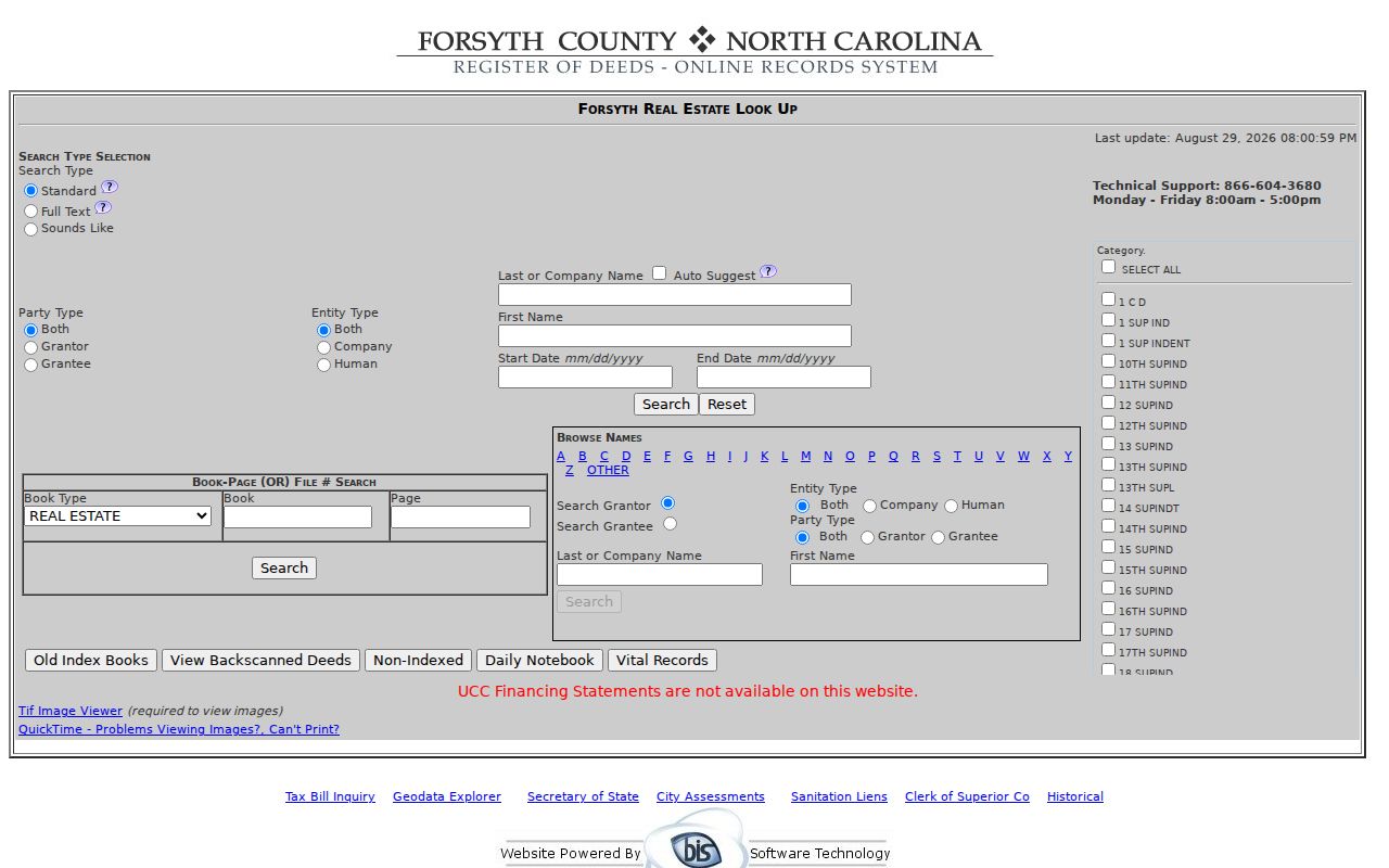
The BIS image shows the name, category, and date choices used to turn a Kernersville parcel lead into a recorded deed trail.
Kernersville Voter Registration Layer
Voter information is a separate record layer, not an address directory. NCSBE Voter Search takes a required first name and last name, then allows a middle initial, year of birth, county, and voter status. The statewide file can contain a residence or mailing address, county voter ID, party, precinct, districts, age, race, sex, and voting history, subject to the published limits. Search the county and status, and retain the result's date and label.
The full voter file is updated weekly on Sundays and is available by statewide or county download. G.S. 163-82.10 also provides a request route for county and precinct lists with specified filters and permitted actual-cost charges. Full and partial Social Security numbers, date of birth, and driver-license numbers are excluded. Qualifying protective orders and the Address Confidentiality Program can protect an address. Do not turn a registration row into a claim that someone occupies a Kernersville address.
Kernersville Oakhurst Street History
Address history is part of a good Kernersville street directory search. Oakhurst Street and Oakhurst Drive were consolidated into Oakhurst Street by an April 2010 resolution tied to emergency-response accuracy. Search both forms in older deeds and directories, preserve the form found on the record, and then test the current equivalent. Town standards also describe street renaming after closures, realignments, or disconnected remnants.
Forsyth's road-name history material documents many changes from 1979 through 2000. The 1960 and 1962 directories arrange numbered streets numerically and named streets alphabetically, with crossing streets marked at intersections. That format is useful for deciding whether a changed label or number, rather than a move, caused a missing result.
Kernersville Boundary Block Checks
The county line can run through the practical work of a Kernersville street directory. Most municipal land lies in Forsyth, with a portion in Guilford. ZIP 27284 can reach Forsyth, Guilford, and Davidson addressing areas. Guilford's 2024 resolution asked for surveying and mapping of an uncertain Forsyth-Guilford boundary affecting about 250 parcels, and a 2026 session law removed one specified parcel from Town limits.
For a block near that line, check both the county parcel viewer and the Town limits layer before asking for deeds, court records, permits, or election details. Label each map with its source and date. The Town GIS and Development Services, county counters, public-records requests for existing maps, and a survey or title professional are the documented fallback routes when a boundary or ownership issue cannot be resolved online.
Kernersville Historic Street Pages
Historic street pages add the household layer that tax and deed records do not provide. The 1960 Hill's directory uses green householder pages with numbered streets in numerical order and named streets alphabetically. Names appear opposite addresses, with intersecting streets at crossings and owner or tenant notation where the publisher supplied it. The blue numerical telephone section offers a second historical route from number to name.
Use the original spelling, address form, edition year, and page image in notes. Then pair the listing with a dated deed, tax record, newspaper item, or census. The confirmed Digital NC items are 1960 and 1962; do not assume a continuous online run beyond them. Paddison Memorial Library, the Forsyth Library North Carolina Collection, newspaper index, microfilm, and State Archives are the next places to ask about the historical street context. The historical collections themselves are explored in the city-directory section of the site.
Kernersville Street Directory Limits
A street directory cannot establish every person behind every door. Tax ownership is not occupancy. A voter entry is a registration record with status and confidentiality rules. A historic directory is a dated publisher's snapshot. Court, vital, juvenile, sealed, expunged, and protected records have their own access boundaries. Even an adjacent parcel map only shows a property relationship, not a license to assemble a live profile of the people around it.
Lawful use. Use Kernersville address records for personal, lawful research, family history, estate questions, or civic transparency. Do not use them to stalk, harass, intimidate, or harm any person.
When an online search stops, use the documented channel for that record: Tax, ROD, Town Clerk, Development Services, Elections, the library, the Archives, or the Clerk. A no-match from one system is not proof that a person or property does not exist.