
Kernersville ZIP Code Coverage
The documented Kernersville ZIP code directory has two distinct labels, 27284 and 27285, plus nearby postal areas that can overlap the search area. The principal label, 27284, can reach Forsyth, Guilford, and Davidson county addressing areas. The reviewed source identifies 27285 as a PO-box-only Kernersville ZIP. Neither fact identifies a particular parcel, street, or household. For an address search, keep the postal ZIP with the full street address, then verify the parcel county and municipal status before selecting a Tax office, deed index, clerk, or election office.
| ZIP | Areas covered | Post office / mail status | Record-search note |
|---|---|---|---|
| 27284 | Principal Kernersville postal area; can extend into Forsyth, Guilford, and Davidson addressing areas | Kernersville city ZIP; reviewed source does not name a station | Check county, parcel, and Town limits before choosing a custodian. |
| 27285 | Kernersville mailing designation | PO-box-only ZIP in the reviewed source | Do not treat a box ZIP as a residential parcel location. |
| Nearby overlapping ZIPs | Surrounding address systems may appear in county, Census, or postal material | Not fully inventoried in the research | Confirm the exact address with an official postal reference and map. |
Kernersville's town land is split between Forsyth and Guilford, while the principal ZIP can be broader still. That is why a Kernersville mailing address may not point to the same local office as another address with the same postal city. Note: the reviewed material does not provide a complete USPS polygon or post-office list for every overlapping mailing area.
For a clear view of that distinction, the North Carolina municipal land-area table is captured below.
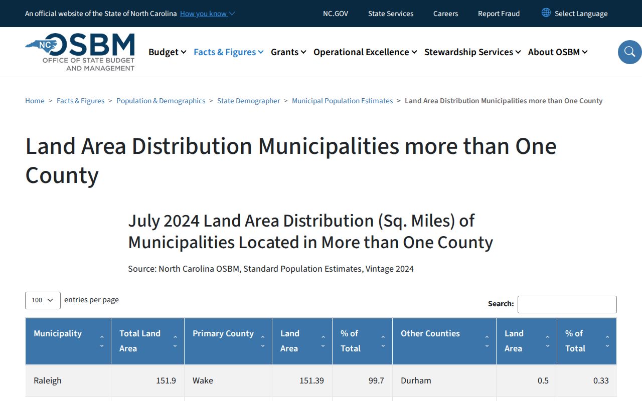
It supports the county split, not a postal-boundary claim. Pair it with the individual parcel record when an address sits near the municipal edge.
Kernersville ZIP Code Scope
ZIP geography is only one layer around a Kernersville address. Town limits, the extraterritorial jurisdiction, county lines, ZIP polygons, postal-city labels, school and fire districts, and election precincts can each follow a different line. The Town GIS hub offers municipal-limits, zoning, land-use, watershed, school, fire, and county-tax layers, but it describes its information as reference material rather than a warranty. The Town's municipal-limits page also carries an older stated update date, so current county data and later boundary action matter.
The practical order is county first, ZIP second. A full location can be checked in the Town GIS hub and then in the county parcel tools. A ZIP label alone should never decide which records office holds a deed, tax record, court file, or public request.
Kernersville ZIP Code Parcel Searches
Forsyth's parcel tools do not present a documented ZIP-only resident search. They do provide the closest local method: search an official address, inspect the returned rows, and filter or group them by ZIP only if that attribute is exposed in the result. The Tax Parcel Viewer also permits a drawn shape or point buffer, so a bounded area can be examined without assuming that all addresses sharing a postal label are in one jurisdiction. Results may be exported to CSV, with a limit of 1,000 records per batch.
| Parcel-viewer field | Use for a ZIP-area search |
|---|---|
| Official Address | Accepts partial addresses and documented street-type abbreviations; use this as the starting address key. |
| Owner Name | Accepts last name followed by first name and partial text; it is not a ZIP filter. |
| Parcel Number or REID | Moves a confirmed parcel between the map and property information tools. |
| Block and Lot | Helps narrow a mapped subdivision or local parcel sequence where available. |
| Drawn shape or buffer | Limits a map result to a visible area; a point works best for the buffer tool. |
The Forsyth County Tax tools image below is the county entry point for property, sales, map, and tax functions.
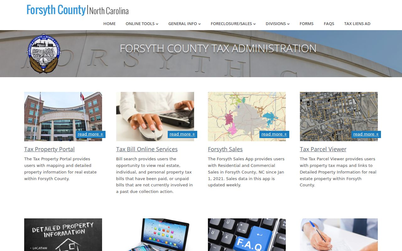
After locating a parcel, copy its REID or PIN exactly. Those identifiers are more stable for a deed or record-card follow-up than a ZIP alone.
Kernersville ZIP Code Population Context
Population tables can describe an area without naming the people in it. The Census QuickFacts and P1 materials are useful for dated aggregate context, not for a household search or a list of residents. Use them to understand the scale of a town-area result, then return to a source that is actually keyed to an address, parcel, directory year, or public record.
The Census QuickFacts display for Kernersville illustrates that aggregate role.
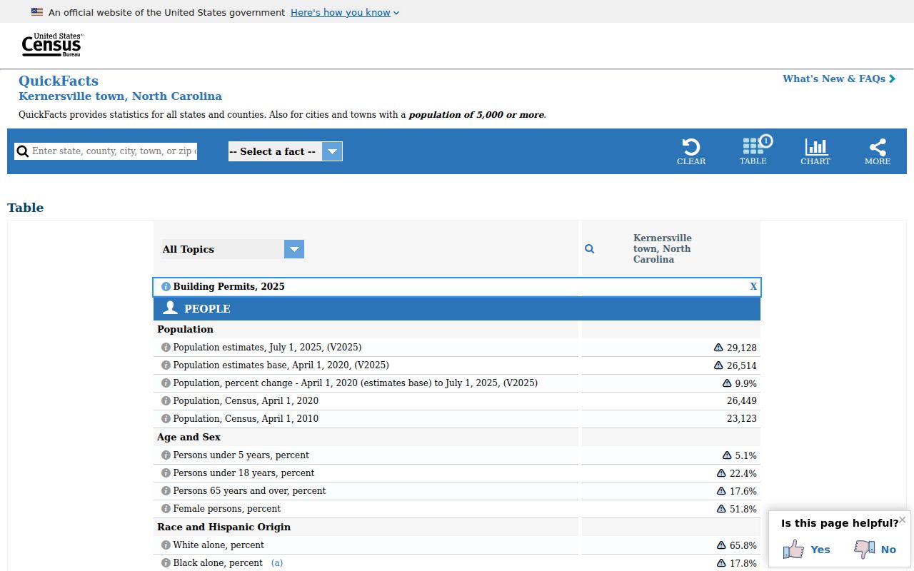
Its figures should be labeled by source and date, especially because the research found different area measurements in Town and Census material.
Finding Kernersville Residents by ZIP
Use a ZIP as a narrowing device, then choose the record by its real search key. The postal directory works best when a full address is already known. A Tax or GIS search can identify the parcel; the map can show its county and adjoining geography; a voter search can be narrowed to Forsyth County and checked by precinct; and a deed search uses names, dates, book and page, or instrument data rather than ZIP. A voter match shows a registration record, not proof that someone is presently at an address.
- Enter the official address in the Forsyth Tax Parcel Viewer, then save the REID or PIN and county shown for the parcel.
- Use a drawn shape or buffer only for a bounded local area, and filter returned records by ZIP only when that attribute appears in the output.
- For a registration question, use the NC State Board of Elections Voter Search with the county and status controls, then confirm the precinct and protected-address limits.
- Search the Forsyth Register of Deeds online lookup by its supported name, date, category, book/page, or file fields, not as a ZIP directory.
Once a ZIP-area result is narrowed to a named street, use the Kernersville street directory for the fuller address-by-address sequence. Note: NCSBE files update weekly on Sundays, and registration data needs a source date before it is compared with any other record.
Kernersville ZIP Record Channels
When the online result stops, the ZIP does not create a new records channel. County GIS and Tax are available online, at the counter, and by phone for parcel questions. Town GIS and Development Services handle local map and addressing context. The Board of Elections handles precinct, district, and voter-list questions through its online tools, files, and county office routes. The Register of Deeds has online, counter, mail, and e-file channels, while the Clerk and courthouse terminal handle court material by its own access rules. For postal questions, use an official postal reference rather than a parcel map.
For an old address, the library, Digital NC, and the State Archives may be more useful than a current map. Library staff, microfilm, online collections, the Archives catalog, and a copy request provide different historical paths. For a Town-held existing map or planning record, submit the public-records request online, by emailed PDF, or in person under Chapter 132 rather than requesting a newly compiled resident list.
Historical street pages in Digital NC's 1960 Kernersville directory are arranged by address, not ZIP. They can test an older street spelling or numbered address after the county and period have been confirmed.
Kernersville ZIP Boundary Checks
The Forsyth-Guilford line is a practical ZIP-search trap. A February 2024 Guilford County resolution says an uncertain line affects about 250 parcels and requested survey, marking, and mapping work. For a target close to that line, check the parcel in both county systems before sending a request or treating a no-result as final. The ZIP result may look consistent while the deed, tax, election, or local-government custodian changes across the boundary.
The Guilford County boundary-resolution record is shown here because it documents the county-line issue.
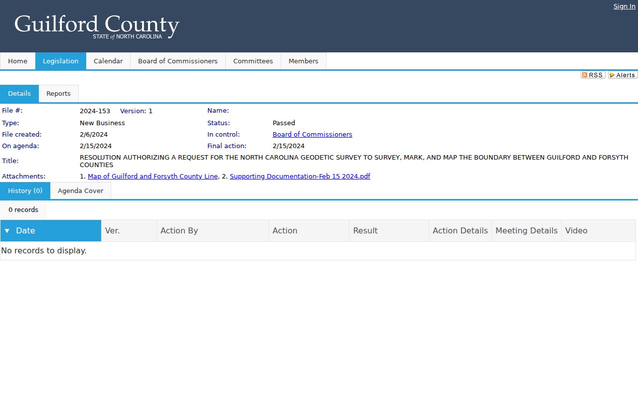
It is a boundary-method source, not a complete parcel answer. The parcel map, record date, and responsible county office still control an individual request.
Kernersville ZIP Code Limits
A postal boundary and a Kernersville city limit answer different questions. Postal routing does not decide whether a parcel is in Town limits, in the ETJ, or in a particular county. The same is true of a school, fire, or election district. A full location should therefore carry its address, ZIP, county, parcel identifier, map source, and source date. The ZIP code directory is a useful index, but it cannot convert an address into a legal boundary decision or a current-residency claim.
- ZIP and ZIP+4
- A ZIP is a postal sorting area. ZIP+4 adds a more specific delivery segment, but it is still a mailing designation rather than a parcel boundary.
- PO-box ZIP
- A ZIP assigned for post-office boxes. The reviewed source identifies 27285 this way, so it should not be turned into a street location.
- Unique ZIP
- A postal code used for one institution or organization. The research does not identify one for Kernersville, so none is listed here.
- Carrier route
- A mail-delivery grouping within a postal area. It is not a public property-title, voter, or resident-record category.
Kernersville Address Grid Changes
ZIP searching also depends on writing the address in the form local records recognize. Town standards describe a coordinate-style grid using number, directional prefix where relevant, street name, street type, and standard addressing terms. Numbers increase from base lines and meridians, while directional prefixes can matter on streets that cross them. The 2025 standards also address renaming after closures, realignments, or disconnected remnants. Preserve the street form printed on an older document, then test a current equivalent separately.
This avoids a quiet false negative when a historical directory, map, or deed uses a different street label from today's parcel viewer.
Kernersville ZIP Code Map Dates
Map results need dates. A 2026 North Carolina session law removed PIN 6896-04-9921 from Kernersville limits, showing why a present-day ZIP or map answer should not be projected backward. The law is an example of method, not a statement about every nearby parcel. Use the current municipal map, county parcel record, and dated legislation together when a limit question affects where records should be requested.
For that example, read North Carolina Session Law 2026-22, then preserve the source date with the map result. This keeps a ZIP search tied to the right geography rather than a postal assumption.